

Key Takeaways
- Iceland straddles two tectonic plates, making it one of the most geologically active places on Earth.
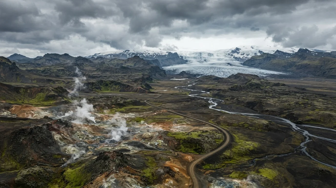
- Glaciers cover roughly 11% of the island, even as volcanic heat shapes the terrain beneath them.
- Geysers and hot springs exist because groundwater interacts with geothermal heat near volcanic systems.
- Iceland's fjords were carved by glaciers during past ice ages, not by current volcanic activity.
- Understanding the geography helps travelers plan smarter - terrain and weather vary dramatically by region.
Iceland's Geological Identity
Iceland is a North Atlantic island built almost entirely from volcanic activity. It sits directly on the Mid-Atlantic Ridge, the boundary where the North American and Eurasian tectonic plates slowly pull apart. This unique position means the island is constantly being reshaped by eruptions, earthquakes, glacial movement, and geothermal heat rising from below the surface.
Iceland is also located over a mantle plume - a hotspot of unusually hot rock welling up from deep within the Earth - which amplifies the volcanic activity beyond what plate boundaries alone would produce.
A Island Built From the Inside Out
Most islands form at the edges of continents or through ancient collisions. Iceland formed differently - it was built up from the ocean floor by repeated volcanic eruptions over roughly 20 million years. The island continues to grow and shift today, which is why travelers often describe it as feeling raw and unfinished in the most awe-inspiring way.
The driving force is the Mid-Atlantic Ridge, a crack in the ocean floor where two tectonic plates are slowly spreading apart. Iceland is the only place on Earth where this ridge rises above sea level, making the planet's geological interior directly visible and accessible. In the Thingvellir National Park in the southwest, visitors can literally walk between the two plates in a rift valley - one of the most striking geological experiences on Earth.
Thingvellir: A UNESCO World Heritage Site
Thingvellir National Park is recognized not only for its geological significance but also for its historical importance as the site of Iceland's ancient parliament, the Althing, established in 930 CE. It's one of the few places in the world where cultural and geological heritage intersect so visibly. Verify current visitor access rules before your trip, as certain areas may have restrictions.
Glaciers, Ice Caps, and the Forces That Shape Them
Despite its volcanic nature, about 11% of Iceland is covered by glaciers and ice caps. Vatnajökull in the southeast is the largest glacier in Europe by volume, sitting atop several active volcanic systems. When eruptions occur beneath it, the results can be catastrophic: rapid melting sends enormous floods of water and ice rushing across the surrounding plains.
Glaciers have also been Iceland's great sculptors over geological time. During past ice ages, massive sheets of ice carved the deep, narrow inlets - fjords - that define Iceland's western and eastern coastlines. The Westfjords region, with its deeply indented peninsulas and steep-walled valleys, is the oldest part of Iceland and shows the most extensive glacial carving.
11%
Of Iceland covered by glaciers
According to the Icelandic Meteorological Office, glaciers cover approximately 11% of the island's total land area, though that coverage has been decreasing over recent decades.
~30
Active volcanic systems in Iceland
Geoscientists estimate Iceland has around 30 active volcanic systems, more than almost any comparably sized landmass on Earth.
~2.5 cm
Annual plate spreading rate
The North American and Eurasian plates separate at roughly 2-2.5 centimeters per year along the Mid-Atlantic Ridge beneath Iceland.
Geothermal Energy and Why the Ground Steams
Travelers arriving in Reykjavík often notice steam rising from vents in the earth - this is geothermal activity, not pollution. Rainwater and snowmelt seep deep underground, where volcanic heat warms or superheats the water. That heated water then rises back to the surface as hot springs, mud pools, or - under specific pressure conditions - geysers.
Iceland's geothermal landscape isn't just scenic. The country harnesses this energy to heat roughly 90% of its homes and generate a significant portion of its electricity. For visitors, it means natural hot springs are common, often free, and found far beyond the well-known tourist sites.
Finding Natural Hot Springs Beyond the Crowds
While the most famous geothermal bathing sites attract large numbers of visitors, Iceland has many smaller, lesser-known hot springs scattered across the countryside - particularly in the north and in the Westfjords. Researching these before your trip through local tourism offices or verified travel guides can help you find quieter, equally memorable experiences. Always confirm access is permitted and respect the natural environment.
How Geography Should Shape Your Travel Planning
Iceland's varied terrain means conditions differ dramatically between regions. The south coast - exposed to Atlantic weather systems - tends to be wetter and windier. The north sees colder, drier winters but can offer clearer skies for Northern Lights viewing. The highland interior, known as the Highlands or hálendi, is only accessible by rugged four-wheel-drive vehicles and is entirely closed to road traffic in winter.
Understanding the geology also helps set expectations about what you'll encounter. Lava fields covered in bright green moss stretch across the Reykjanes Peninsula. Black sand beaches in the south, like Reynisfjara, are made from eroded basalt - the same volcanic rock found in lava flows. Waterfalls like Skógafoss and Seljalandsfoss exist because glacial meltwater pours over ancient lava escarpments. Every landform tells part of the same geological story.
Before visiting, check current conditions and any active volcanic or road advisories with the Icelandic Meteorological Office and the Icelandic Road and Coastal Administration, as conditions can change quickly and some areas may be restricted for safety reasons.